![](/images/other/stat-length.png)
![Excursión Caballo La Baule-Escoublac - tour a la baule - Photo](https://media.geolcdn.com/t/1900/400/ext.pjpeg?maxdim=2&url=https%3A%2F%2Fstatic1.geolcdn.com%2Fsiteimages%2Fupload%2Ffiles%2F1524743154cheval.jpg)
tour a la baule
roi
Usuario
![Longitud](/images/other/stat-length.png)
Longitud
12,3 km
![Altitud máxima](https://static1.geolcdn.com/siteimages/upload/files/1508320355ic_sort_altitude_max_24dp.png)
Altitud máxima
44 m
![Desnivel positivo](https://static1.geolcdn.com/siteimages/upload/files/1508320355ic_sort_den_pos_24dp.png)
Desnivel positivo
95 m
![Km-Effort](/images/other/stat-length.png)
Km-Effort
13,6 km
![Altitud mínima](https://static1.geolcdn.com/siteimages/upload/files/1508320355ic_sort_altitude_min_24dp.png)
Altitud mínima
0 m
![Desnivel negativo](https://static1.geolcdn.com/siteimages/upload/files/1508320355ic_sort_den_neg_24dp.png)
Desnivel negativo
101 m
![Boucle](https://static1.geolcdn.com/siteimages/upload/files/16400158638029165_repeat_loop_refresh_sync_direction_icon.png)
Boucle
Sí
Fecha de creación :
2015-08-07 00:00:00.0
Última modificación :
2015-08-07 00:00:00.0
![Caballo](https://static1.geolcdn.com/sitytour/trail-icons/300.png)
1h48
Dificultad : Muy fácil
![Escanee este código QR para abrir la excursión en la aplicación SityTrail](https://capi.geolives.com/qq0zvz2zws4bq2lad0pu/sitytour/trails/455767/qr.png?size=200)
Aplicación GPS de excursión GRATIS
A propósito
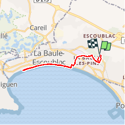
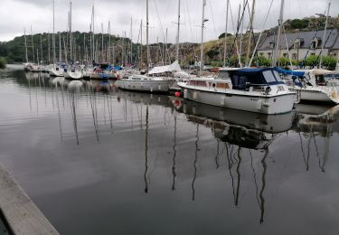
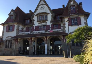
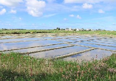
Ruta Caballo de 12,3 km a descubrir en Países del Loira, Loira-Atlántico, La Baule-Escoublac. Esta ruta ha sido propuesta por roi.
Descripción
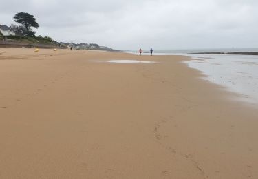
Vans garés que uno argent, à l'entrée de la plage. Forêt SUPERBE sympa et extrêmement bien aménagé pour les chevaux. Allers retours tranquille sur la plage. Top
Localización
País:
France
Región :
Países del Loira
Departamento/provincia :
Loira-Atlántico
Municipio :
La Baule-Escoublac
Localidad:
Unknown
Salida:(Dec)
Salida:(UTM)
548427 ; 5237004 (30T) N.
Comentarios
Excursiones cerca
![Excursión Senderismo Pornichet - promenade sur la plage - Photo](https://media.geolcdn.com/t/375/260/ext.jpg?maxdim=2&url=https%3A%2F%2Fstatic1.geolcdn.com%2Fsiteimages%2Fupload%2Ffiles%2F1553511878bg_sport_marche.png)
![Senderismo Senderismo](https://static1.geolcdn.com/sitytour/trail-icons/101.png)
promenade sur la plage
Senderismo
Muy fácil
(1)
Pornichet,
Países del Loira,
Loira-Atlántico,
France
![](/images/other/stat-length.png)
4,1 km | 4,4 km-effort
48min
![](https://static1.geolcdn.com/siteimages/upload/files/16400158638029165_repeat_loop_refresh_sync_direction_icon.png)
Sí
![Excursión A pie La Baule-Escoublac - La petite marchande - Photo](https://media.geolcdn.com/t/375/260/b24b4250-06ce-4584-9aac-6ea2632f3c33.jpeg&format=jpg&maxdim=2)
![A pie A pie](https://static1.geolcdn.com/sitytour/trail-icons/100.png)
La petite marchande
A pie
Fácil
La Baule-Escoublac,
Países del Loira,
Loira-Atlántico,
France
![](/images/other/stat-length.png)
10,3 km | 11,4 km-effort
2h 35min
![](https://static1.geolcdn.com/siteimages/upload/files/16400158638029165_repeat_loop_refresh_sync_direction_icon.png)
Sí
![Excursión Senderismo La Baule-Escoublac - gare de Pornichet - Photo](https://media.geolcdn.com/t/375/260/ext.jpg?maxdim=2&url=https%3A%2F%2Fservices.sitytrail.com%2FGeolivesWS%2FDownloadMedia.ashx%3FTrailID%3D993054%26Media%3D20180624205634.jpg)
![Senderismo Senderismo](https://static1.geolcdn.com/sitytour/trail-icons/101.png)
gare de Pornichet
Senderismo
Muy fácil
La Baule-Escoublac,
Países del Loira,
Loira-Atlántico,
France
![](/images/other/stat-length.png)
6,1 km | 6,9 km-effort
1h 25min
![](https://static1.geolcdn.com/siteimages/upload/files/16400158638029165_repeat_loop_refresh_sync_direction_icon.png)
Sí
![Excursión Marcha nórdica Pornichet - pornichet, ste Marguerite, hippodrome, port - Photo](https://media.geolcdn.com/t/375/260/5014ac05-bc50-4050-bdb1-018e9a4685dd.jpg&format=jpg&maxdim=2)
![Marcha nórdica Marcha nórdica](https://static1.geolcdn.com/sitytour/trail-icons/102.png)
pornichet, ste Marguerite, hippodrome, port
Marcha nórdica
Muy fácil
Pornichet,
Países del Loira,
Loira-Atlántico,
France
![](/images/other/stat-length.png)
8,4 km | 9,3 km-effort
1h 15min
![](https://static1.geolcdn.com/siteimages/upload/files/16400158638029165_repeat_loop_refresh_sync_direction_icon.png)
Sí
![Excursión Senderismo Pornichet - la Roche Bernard : les rosquets - Photo](https://media.geolcdn.com/t/375/260/4c26c2a3-d40c-4349-9ce6-405d71765763.jpg&format=jpg&maxdim=2)
![Senderismo Senderismo](https://static1.geolcdn.com/sitytour/trail-icons/101.png)
la Roche Bernard : les rosquets
Senderismo
Fácil
Pornichet,
Países del Loira,
Loira-Atlántico,
France
![](/images/other/stat-length.png)
32 km | 37 km-effort
5h 48min
![](https://static1.geolcdn.com/siteimages/upload/files/16400158638029165_repeat_loop_refresh_sync_direction_icon.png)
No
![Excursión Senderismo La Baule-Escoublac - gare La Baule Escoubac - Photo](https://media.geolcdn.com/t/375/260/ext.jpg?maxdim=2&url=https%3A%2F%2Fservices.sitytrail.com%2FGeolivesWS%2FDownloadMedia.ashx%3FTrailID%3D994300%26Media%3D20180626202507.jpg)
![Senderismo Senderismo](https://static1.geolcdn.com/sitytour/trail-icons/101.png)
gare La Baule Escoubac
Senderismo
Muy fácil
La Baule-Escoublac,
Países del Loira,
Loira-Atlántico,
France
![](/images/other/stat-length.png)
5,1 km | 5,7 km-effort
1h 2min
![](https://static1.geolcdn.com/siteimages/upload/files/16400158638029165_repeat_loop_refresh_sync_direction_icon.png)
Sí
![Excursión Senderismo Guérande - Guérande_Careil - Photo](https://media.geolcdn.com/t/375/260/ext.jpg?maxdim=2&url=https%3A%2F%2Fservices.sitytrail.com%2FGeolivesWS%2FDownloadMedia.ashx%3FTrailID%3D415908%26Media%3D52a60e6b-5068-4f71-b8f3-923b38638fa7.jpg)
![Senderismo Senderismo](https://static1.geolcdn.com/sitytour/trail-icons/101.png)
Guérande_Careil
Senderismo
Medio
Guérande,
Países del Loira,
Loira-Atlántico,
France
![](/images/other/stat-length.png)
13,5 km | 14,8 km-effort
4h 0min
![](https://static1.geolcdn.com/siteimages/upload/files/16400158638029165_repeat_loop_refresh_sync_direction_icon.png)
Sí
![Excursión Bici de montaña La Baule-Escoublac - Cyril La Baule - Photo](https://media.geolcdn.com/t/375/260/ext.jpg?maxdim=2&url=https%3A%2F%2Fstatic1.geolcdn.com%2Fsiteimages%2Fupload%2Ffiles%2F1524743154velo.jpg)
![Bici de montaña Bici de montaña](https://static1.geolcdn.com/sitytour/trail-icons/202.png)
Cyril La Baule
Bici de montaña
Medio
La Baule-Escoublac,
Países del Loira,
Loira-Atlántico,
France
![](/images/other/stat-length.png)
28 km | 30 km-effort
2h 3min
![](https://static1.geolcdn.com/siteimages/upload/files/16400158638029165_repeat_loop_refresh_sync_direction_icon.png)
Sí
![Excursión sport Pornichet - Briere an avril - Photo](https://media.geolcdn.com/t/375/260/ext.jpg?maxdim=2&url=https%3A%2F%2Fsecurestorage.geolives.com%2Fsitytour%2Ftrail-bg%2Fdefault.jpg)
Briere an avril
sport
Muy fácil
Pornichet,
Países del Loira,
Loira-Atlántico,
France
![](/images/other/stat-length.png)
22 km | 25 km-effort
Desconocido
![](https://static1.geolcdn.com/siteimages/upload/files/16400158638029165_repeat_loop_refresh_sync_direction_icon.png)
No